
Chino Hills and Brea are widely touted, among other things, for their community amenities, including well-maintained parks, good libraries, highly-rated schools and sophisticated, upscale shopping. These are all valid reasons to live in these cities, but for those who live in Carbon Canyon, there is one perhaps more important than all of the others: the opportunity to live in a more rural, open setting than can be found anywhere else in our communities. As threatened as the canyon setting is by development, there are still plenty of ways to find and admire the beautiful canyon environment.
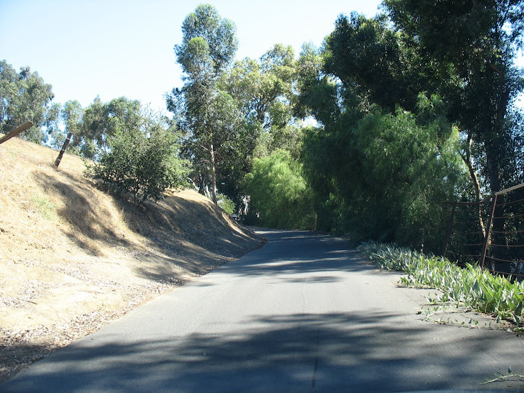
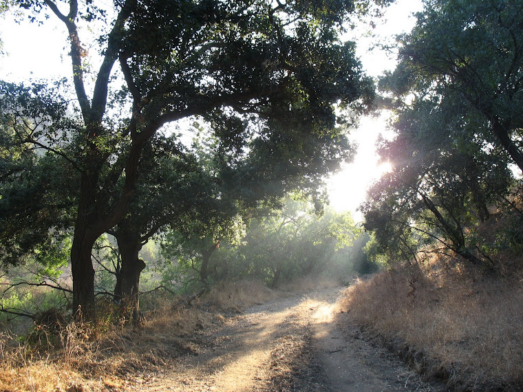
This morning I had another reminder on my hike* through Soquel Canyon just south of Carbon Canyon. Within a short distance of home is a world that is filled with interesting scenery, remnants of history, quiet and solitude, and a refreshing escape from everyday life. While all of this can generally be found in Chino Hills State Park, which lies just south of Soquel Canyon, the difference is that its isolation keeps Soquel even more untrammeled by human activity.
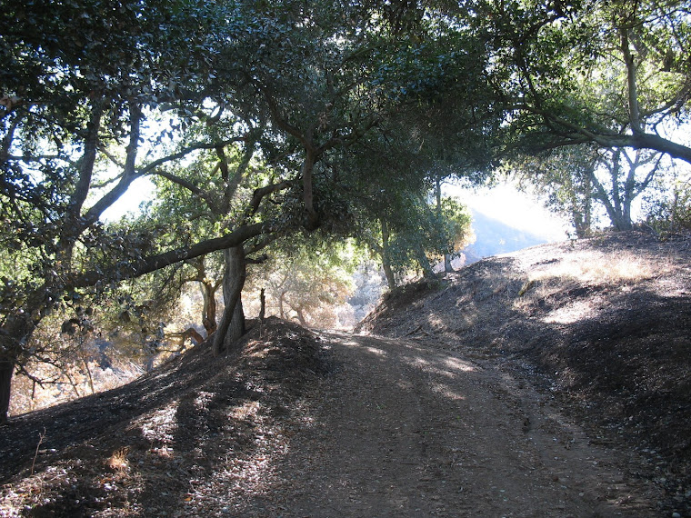
I left home a little before 6, hoping to keep most of my hike in the cooler morning hours. Still, climbing and descending the hills can be brutal on fire roads on which the goal is to get a vehicle uphill as fast as possible, usually on steep grades. Fortunately, the temperature was manageable, even though I broke a good, little sweat, on the uphill and just had to watch my knees on the downhill.
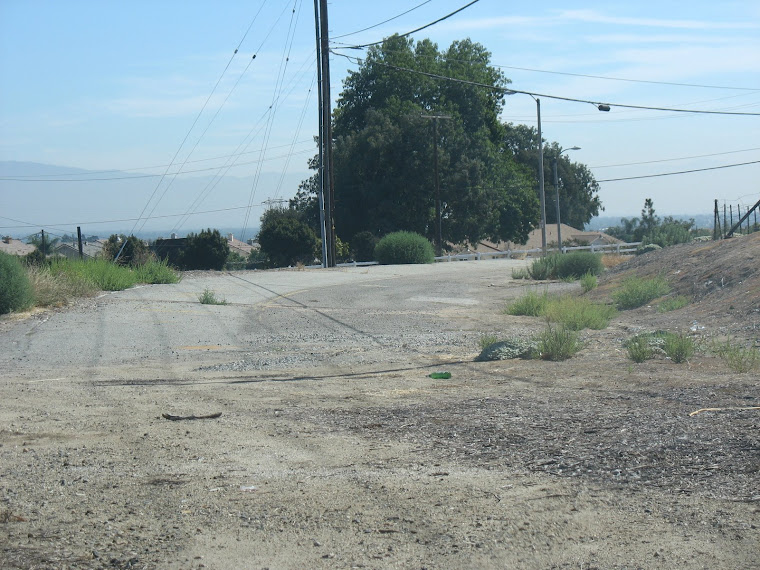
Emerging at the canyon bottom after about 1 hour or so (and this was after stopping to take many photos--see above and at the bottom of the blog screen), I came out to an area that seemed to have been used for horse staging or events of some kind. Small concrete structures, including old bathrooms, were scattered about. I had been in the canyon once before and knew there was an access road to Chino Hills State Park, so I turned east and walked a short distance.
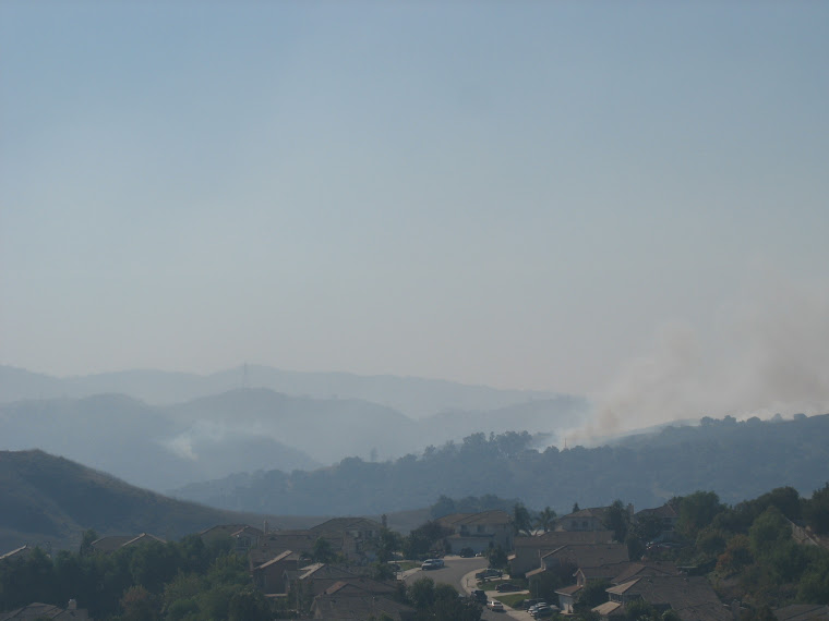
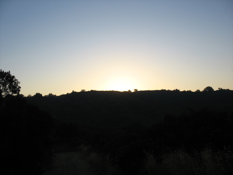
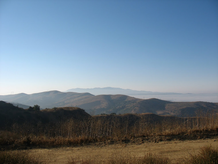
Reaching a spot where there is a large rusting steel derrick (a remnant of early oil exploration or, perhaps, for water), I noticed a cleared road turning to the south and headed up. Initially the grade was fairly easy and a section had a nice canopy of tall, stately oaks, but then I emerged into open sun and a steep grade, not unlike my initial ascent from home, but longer! After perhaps fifteen or twenty minutes of marching uphill (and a few more stops for photos), I reached a junction with a ridge trail in the state park. Naturally, the junction was closed by barbed wire fencing and a carefully secured gate. Stopping to take a photo to the south showing the marine layer over Orange County and Saddleback Peak poking through it with other mountains in the Cleveland National Forest, I enjoyed a little break, encountering the only other people (two runners and a mountain biker) I would see for a long while.
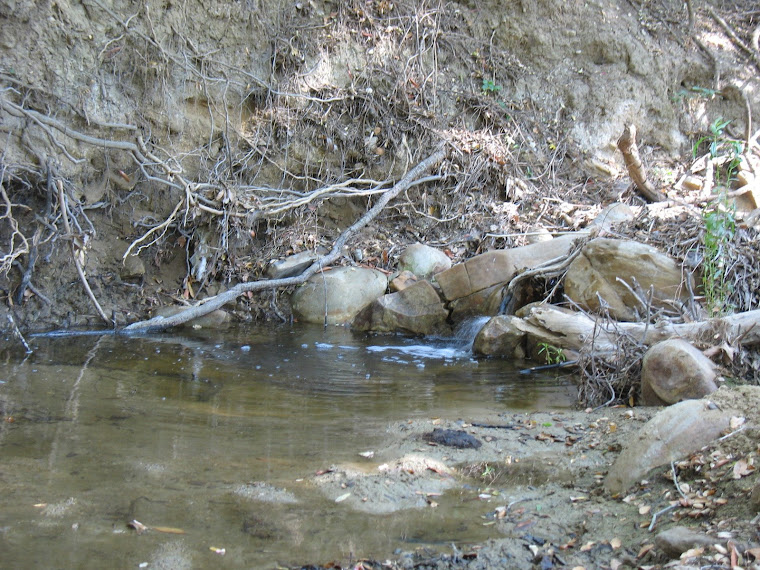
Returning the way I came, I scampered down the road and wound up back at the bottom of Soquel Canyon and turned east once more. Although the creek that winds through the canyon was dry to that point, I heard a trickle of water, then a rush. I noticed a clearing to the south of the road and walked across it. Coming to a barbed wire fence with two strands missing, I ducked under it and headed toward a large oak tree. Here was a beautiful little area where the water splashed over some rocks, making a sweet sound that was mine to enjoy alone. Of course, I can't say if the water (after all, it is July) came from springs, runoff from Vellano Golf Course, or who knows what, but at least it sounded good. Sitting with my back against a gnarled oak that has been there for probably decades and, perhaps, centuries, I enjoyed the isolation, the solitude and the ambience. You do have to watch for the flies and other critters that may want to hitch a ride and infest your home, but it's probably a small price to pay for something as restorative as this little bide-a-while by a picturesque creek in Soquel Canyon. How many of the 120,000 or so residents of Chino Hills and Brea have had an experience like this in their own backyard, rather than watching their big screen in air-conditioned comfort, eating in a chain restaurant, and sipping a Peet's or Starbucks coffee. Nothing against those things--but I can't imagine anyone going to a place like the one I've described and not being affected (though I'm sure there are many who wonder what the big deal is.)
I relunctantly left the creekside break and continued my walk east. I encountered four cattle lazily grazing along the road and gently retreating on my approach. I also stumbled upon the bones of an animal I had seen freshly decomposing on my last trip a few years back. Not long afterward, however, I came upon the relics of a Cold War canyon legacy that few people know of and fewer would want to know very much about.
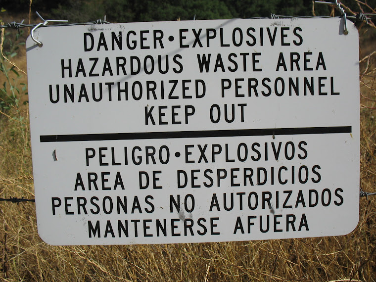
Shortly after World War II and during the height of the hysteria that gripped Americans and Russians and led to the insane atomic weapon buildup that culminated in the late 1960s and early 1970s, a compant called Aerojet began using Soquel Canyon and surrounding areas as a testing laboratory for chemicals and fuels associated with weapons (yes, weapons of mass destruction.) Now, I'm not suggesting that all military buildup of arsenals is bad, but time will show that we and the Soviets were on a path to madness, built on paranoia, suspicion, mistrust, misunderstanding, power, etc. etc. The reality of how close we were to nuclear war in 1962 is truly stunning, if we stop to think about it. The trouble is we usually don't bother, but the vast caches of weapons and nuclear material is still an issue that both the United States and Russia have to do a better job of confronting. Anyway . . .
Even though the Aerojet property was closed down in the 1990s and a massive cleanup ensued that have culminated in Chino Hills' most upscale and prestigious real estate development (still, on top of a munitions site!) called Vellano, there are still signs, literally, of the decades of toxic destruction of a beautiful rural setting. After all, no one in 1947 could, presumably, foresee that there would be homes and people out there, could they?
I hopped an old fence to see what was behind the foreboding signs. I heard another little waterfall in the creek and climbed down to the creek to hear it. Just then, a security vehicle rode by but I was adequately concealed. Strange to think that, even though this was all said to have been cleaned up, or maybe just those areas where the homes and golf course are, there is still the need to patrol the area (even on Sundays.) What else could be back there, I wondered?
Not wanting to risk being confronted and unceremoniously evicted from this Cold War relic and feeling the temperature rising as it got toward 10:00, I headed back westward through the canyon, retracing my steps to the road that led me back to Carbon Canyon and home.
That last jaunt (!) up the hill in exposed sun was a tough one and I met a couple walking their dog on the fire road overlooking Carbon Canyon from the south, but at least there was the downhill to home, where cold water and a comfortable couch beckoned. Next time, I'm going to explore points east on the Brea side and we'll see what we see!
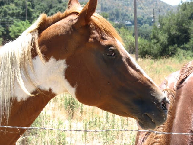
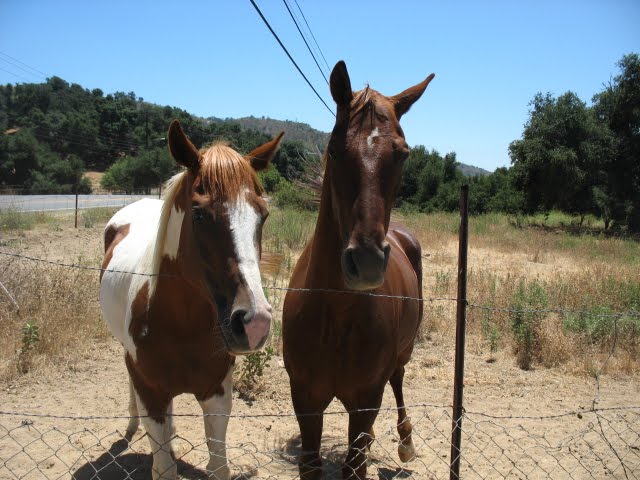
Photos from my excursion are below.
* Kindly note: Access to the areas described in this post constitute trespassing on private property. Caveat emptor transferred to the hiker!


4 comments:
Thank you for this! I've lived in this area my whole life and haven't ever made it off the road to hike or ride the trails. This post and the accompanying photos inspire me to do some exploring of my own.
In your opinion, what is the difficulty of the hikes? Also, are Telegraph and Soquel Canyon accessible from the Yorba Linda side or do you have to track your way in from Carbon Canyon itself?
Hi Scott, sorry for the delay in replying, I didn't see it until tonight.
Not knowing your hiking experience, it's hard to judge difficulty, other than to say that ascending and descending these hills can be a little steep, if not especially long.
Generally speaking, there can be anywhere from 400 to 700 foot elevation gains (sometimes more) going from ridges down to canyons in a relatively short distance. Also, southern-facing sections can be brutal in hot, sunny weather. On my last hike, I left my house at 6 a.m. and made my last climb before 10 and broke out a good sweat on that one.
From Yorba Linda and the Rim Crest entrance to Chino Hills State Park, you could hike down into Telegraph Canyon and then up to the ridge at the northern end of the park. There is a road/trail that leads from that ridge down into Soquel Canyon, but it is fenced with barbed wire, because that part of Soquel Canyon is private property.
I've learned since I left that post that the mouth of Soquel Canyon where it joins Carbon Canyon in Brea is actually within the State Park. Technically, Soquel Canyon Road terminates at Carbon Canyon Road just east of Hollydale Mobile Home Estates and across from Olinda Drive at Olinda Village. That entrance is fenced (being recently graded for possible sale and development) and is on private property.
So, check out the satellite view on Google Maps (to me, the aerial images on Yahoo Maps are not as good) and you can probably get a good idea of what access points there are.
Thanks again, Paul
Hi Paul,
I am working with Cinnabar to produce education exhibits for the Chino Hills Discovery Center. We are interested in reproducing one of your images in a short video segment. I would be grateful if you could let me know how we can obtain your permission.
Thanks.
Daniel
Hi Daniel, sure, leave an e-mail address for contact. Glad to hear about work progressing at the Discovery Center.
Post a Comment