26 March 2016

A Trek Through Chino Hills State Park

Yesterday's excursion in the Chino Hills north of Carbon Canyon was a qiuck walk around the block compared to today's marathon 15-mile trek through Chino Hills State Park (with a 13-year old, no less.)

A portion of the South Ridge Trail looking westward.
The hike began at the park's Discovery Center in Brea at about 8:30 or so, with the intention of heading up the North Ridge Trail, which overlooks Carbon and Soquel canyons.

Just one of many spots along the South Ridge Trail to take in panoramic views of inland Orange County and nearby areas.
But, the trail was closed, apparently because of some unstable areas, so plans were altered to head up Telegraph Canyon and, then about 1 1/2 miles in, a quick, steep ascent up the Diemer Trail (named for Metropolitan Water District of Southern California chief Robert Diemer, for whom the adjacent water treatment plant is also named) to the South Ridge Trail.

A nice detail of the rolling hillsides and taller hills northeast of the South Ridge Trail, with remnants of a few short poles, some with lines still attached, that appear to be from a late 19th-century telegraph line from the new towns of Chino to Carlton.
The walk then headed east along with some steep ascents and descents and spectacular views to the south and west, albeit with some coastal haze, towards inland Orange County and out towards the Santa Ana Mountains.

It had been some years, probably fifteen or so, since this blogger had been on this trail, so, while the views were not surprising, what had been forgotten was just how close some of the housing tracts in Yorba Linda are to the state park.

A section of the South Ridge Trail literally runs along the backwards of several Yorba Linda tract houses at the Rimcrest entrance.  Great for local access to wildland areas, but graffiti and broken better bottles were found at nearby overlook.
In fact, the Rimcrest entrance is very convenient, because it is just steps from that street to the park and access via South Ridge or the aptly-named Easy Street Trail, which descends into Telegraph Canyon.

But, the flip side comes with an overlook just to the west of Rimcrest that once had an interpretive sign, but now is a graffiti-marred base, with some rock formations spray-painted, and lots of broken bits of glas from beer bottles to serve as a reminder that sometimes it is made too easy for some people to get to nature.

Another fine view of the park, looking west from the South Ridge Trail.
At any rate, a steep series of climbs along South Ridge east of Rimcrest, where the partiers likely couldn't, or wouldn't, go leaves the mess behind.

Just short of the highest point at that portion of the park, San Juan Hill, is a side trail called Bovinian (bovine meaning "cattle") that winds along a pretty hillside route and then descends and turns into the Desire Trail the further drops down along a nice route to Telegraph Canyon.

A section of the Desire Trail, heading down slope from the South Ridge Trail, via the Bovinian Trail, to Telegraph Canyon.
Here the trail terminates at Four Corners, which is one of the central points of the park.  A covered picnic area, interpretive signage and maps, and a Porta-Pottie are there to provide a nice place to rest.  Having gone some 8+ miles to that point, there was about a half-hour break before the hike pressed on.  From there, Telegraph Canyon continues east, Raptor Ridge heads northeast, and the Gilman and McDermont trails head north to the North Ridge Trail.

Reached by several trails, Four Corners is a great place to stop and rest and enjoy the wide open spaces and solitude of Chino Hills State Park.
Following Telegraph Canyon westward, just a couple of hundred feet or so away, leads to McDermont Springs, one of the few places where there is water within the park.  From there, it is a good 6 1/2 miles or so along the mostly flat road back towards the Discovery Center.

Just off the Telegraph Canyon Trail a short distance west of Four Corners (where the trees are at the upper left) is McDermont Springs, one of the few water sources in the park.
The first part of the walk features some abundant shade, tall and spreading oaks and sycamores, and the Aliso Creek running alongside the trail.  There was a nice spot south of the road with a picnic table near the creek and well-shaded by oaks, with an impressive oak grove across the trail.

A nice grove of oaks along the Telegraph Canyon Trail, not far west of Four Corners.
Both along the South Ridge Trail and at Telegraph Canyon are old wooden poles, perhaps 12-15 feet tall, with, in some cases, wire still hanging from them.

Again, it had been years since these areas were last visited, but it dawned that these were almost certainly the old telegraph poles and lines from which the canyon got its name.

The thickly-shaded sections of the Telegraph Canyon Trail are seen in this view looking west from Four Corners.
Recent research has shown that there was a plan in the late 1880s, during the famous population and land boom of the time, when Richard Gird, the owner of Rancho Santa Ana del Chino and the founder of the town of Chino, planned to build a railroad from his new community out to another new townsite, Carlton, on the Olinda Ranch.

The railroad was projected to go through Soquel Canyon and then exit out where it meets Carbon Canyon in today's Olinda Village and then on to Anaheim.  More on this project, which never got beyond the planning stage when the boom went busted by 1889, in a later post on this blog.

Several remnant poles, apparently from that telegraph line, dot the hillside heading north from Telegraph Canyon up to the North Ridge Trail. Click on any photo to see these in enlarged views in a separate window.
But, it seems likely that a telegraph line was built to connect the new towns and that the line ran through the steep terrain of what is now the state park and maybe a dozen poles and pieces of line still remain as physical reminders of that old way of communication.

The last several miles of the walk through Telegraph Canyon were through areas with fewer trees, less shade and wider areas with grasses, cacti and smaller shrubs and trees.  Once the Diemer Trail was reached and the water plant came into view, the home stretch brought a last burst of energy to make that final haul back to the Discovery Center.

One of the prettier portions of Telegraph Canyon, west of Four Corners, on the westbound trek back to the Discovery Center.
It was about 2:30, a little less than six hours from the start, when the Easter weekend adventure ended and it was an eggcellent way to spend an early spring Saturday.

25 March 2016

A Ramble Through the Chino Hills North of Carbon Canyon

A nice shaded section of the route on this afternoon's trek.  Click on any photo to see them in enlarged views in separate windows.
This being a few days into spring and a beautiful one, a jaunt into the Chino Hills about 1 1/2 miles or so north of Carbon Canyon seemed like a great idea and it was a nice ramble along access roads parallelling the TRTP towers recently installed along a west-to-east corridor.

Looking south towards Carbon Canyon, with a bit of the graded Hillcrest housing project just left of center.
This was a walk that was taken along the same route some months ago, but with a significant difference.

One of the behemoth 198-foot TRTP towers striding across the hills from west to east.
The massive 198-foot towers did not yet have the several strands of wire strung from one to the next, but now they, and the multicolored balls that alert aircraft of their presence, are now a very conspicuous presence.  Some of the fine views obtained along the way are now compromised by having the wires in the line of sight.

A spray of purple wildflowers along the route.
Still, depending on where you are on the trek, the towers and wires may be on one side or the other, so there are still plenty of excellent vantage points looking in all directions.

Sunflowers also sprouting along the trail's edge.
For example, a glance to the north or the west can take in Tres Hermanos Ranch, Tonner Canyon, and the Boy Scouts of America camp, recently purchased by the City of Industry.

Looking towards the southeast and to Carbon Canyon and beyond.
Beyond are the towering peaks of the San Gabriel Mountains, the San Jose Hills from Pomona and San Dimas to Walnut and West Covina and the Puente Hills from Rowland Heights over towards Whittier.

This view looks southwest towards Brea and Orange County.
To the south and the east are more of the Chino Hills, large areas bordering Carbon Canyon from the summit in Chino Hills out toward Olinda Village in Brea.

To the northwest and Diamond Bar, the Puente Hills and the San Gabriel Valley.
In the distance are the Santa Ana Mountains and further out can be seen the San Joaquin Hills near Irvine and Newport Beach and, on clearer days than this, the Pacific Ocean.

Looking out to Tres Hermanos Ranch in Tonner Canyon and the San Gabriel range in the distance.
A clear view can be seen from points along the hike of the St. Joseph's Hill of Hope religious community in Lion's Canyon just above Carbon Canyon to the south of the trail, while to the north and west are camp sites, shooting ranges and other facilities from the Boy Scouts reservation.

Another view to the south and towards Carbon Canyon.
Given that some of these latter facilities are not in Tonner Canyon but are in adjacent canyons and locations, it may be that, although Industry has purchased more of the Scouts property, some of the sites may still be used by the scouting organization.

It is said that Industry is looking to convert much of Tonner Canyon to water storage for city needs, but how much of an impact that could have on other uses of the reservation is not known.

A lengthy section of the winding trail is captured here.
As to the still-abundant swaths of oak and walnut woodland habitat, it is nice to see some amount of greenery, even though this winter has brought only a fraction (about 5 inches) of the deluges predicted because of the El Niño storm system.

It looks like there is a chance for some showers from Tuesday to Thursday in the coming week, but how much greener our hills will get is certainly not clear.

Just one of many old, spreading and majestic oaks in our local hills.
Of course, with the Hillcrest housing development of 76 units in process just north of Carbon Canyon east of Sleepy Hollow and with the specter of other projects looking including the Stonecrest property of 28 approved units near the summit in the Chino Hills portion, the pending hearings for the 107-unit Hidden Oaks south of the Canyon, and the appeal of the 162-unit Madrona project north of the canyon between Sleepy Hollow and Olinda Village, the long-term prognosis for the area is still very much in dispute.

An outstanding example of a grove of oaks along the trail.
For the time being, we should enjoy the beauty of what remains in Carbon Canyon while we still have what is still here.

21 March 2016

The Rancho Santa Ana del Chino in the 1870s

The Rancho Santa Ana del Chino covering today's cities of Chino and Chino Hills and extending almost to Sleepy Hollow in Carbon Canyon, was granted in 1841 to Antonio María Lugo, who had his son-in-law, Pennsylvania-native Isaac Williams assume the management of the ranch and then assigned the property to him.  In 1856, Williams died and ownership passed to one of his daughters, whose husband, Robert Carlisle, took control.  Carlisle was killed in 1865 in one of the most famous gun battles in early Los Angeles and Jim Bridger became the manager of the Chino Ranch.

At the time, southern California was just emerging from a punishing drought, which following calamitous floods in 1861-62, had decimated the economic backbone of the region: the cattle industry.  But, as rainfall increased, so did the population as post-Civil War western migration brought thousands of new residents to the greater Los Angeles.

With the growth in people came new businesses, an expanding agricultural foundation for the economy, and a rise in land values for small farms and townsites.  Among these latter was Compton (established 1867) and then a spate of others by the mid-1870s, including Artesia, Pomona, Santa Ana, Orange and San Fernando.

With climbing real estate prices, investors were looking for remaining regional ranches to purchase with an eye for subdivision and sale at great profits.  One such enterpreneur was Isaias W. Hellman (1842-1920).  Born to a Jewish family in what later became Germany, Hellman migrated to America in the late 1850s as a teenager to join relatives in Los Angeles and worked in a cousin's store.

Los Angeles Herald, 9 April 1875.
By the middle Sixties, as the area emerged from the drought and was poised for growth, Hellman went on his own, opening his own store and quickly becoming a success.  He even began to transact an informal banking business (banking was actually illegal for a number of years in California) at the back of his store as a sideline and earned the business of many residents of the Los Angeles region.

In 1868, Hellman formalized his enterprise, taking on two partners in longtime San Gabriel Valley ranchers, William Workman (half-owner of Rancho La Puente) and Workman's son-in-law, F.P.F. Temple (co-owner of Rancho La Merced).  Hellman, Temple and Company was the second bank opened in Los Angeles, following ex-governor John Downey's Hayward and Company by a few months.

While business grew along with the regional economy, fundamental differences in management of the institution arose between Hellman and Temple, and Hellman dissolved the partnership in early 1871.  Downey closed up his bank, joined ranks with Hellman and the pair opened Farmers and Merchants Bank, which became a dominant financial institution in Los Angeles for decades to come.  Temple and Workman formed their own private bank of that name and the two institutions had something of a friendly rivalry as the only commercial banks in the growing city.

It was in 1875, as the local growth boom spiked, that Hellman expanded his growing portfolio of real estate holdings.  Four years before, he and partners bought Rancho Cucamonga, which had been owned by John Rains, another Isaac Williams son-in-law, and, after Rains' murder in 1862, managed for his widow, Merced.  Cucamonga was widely-known for its vineyards and wine and brandy production, which Hellman continued.

Los Angeles Herald, 5 May 1875.
In 1874, he partnered with John Lazzarovitch and William H. Workman (nephew of his former banking partner) in subdividing the Paredon Blanco (White Bluffs) property Workman's wife, Maria, inherited from her father, Andrew Boyle, naming the new subdivision on the east side of the Los Angeles River from downtown Los Angeles Boyle Heights.  Ironically, it was at Paredon Blanco that Americans who had been taken prisoner by Californios at Isaac Williams's house at Chino were kept under lock and key during the last stage of the American invasion and conquest in 1846-47.

On 9 April 1875, the Los Angeles Herald newspaper published a small article titled "The Chino Ranch" in which it was reported
The solid foundation of real estate in Los Angeles county is well demonstrated by the late purchase of a half interest in the above named ranch by Mr. I.W. Hellman . . . [who] on the eve of his departure for Europe he saw no better investment for $150,000 of his surplus capital than to put it in solid ground . . .
Hellman, who had become quite wealthy due to his business acumen, was preparing for his first trip to his homeland since he had left nearly twenty years before.  The Herald continued that
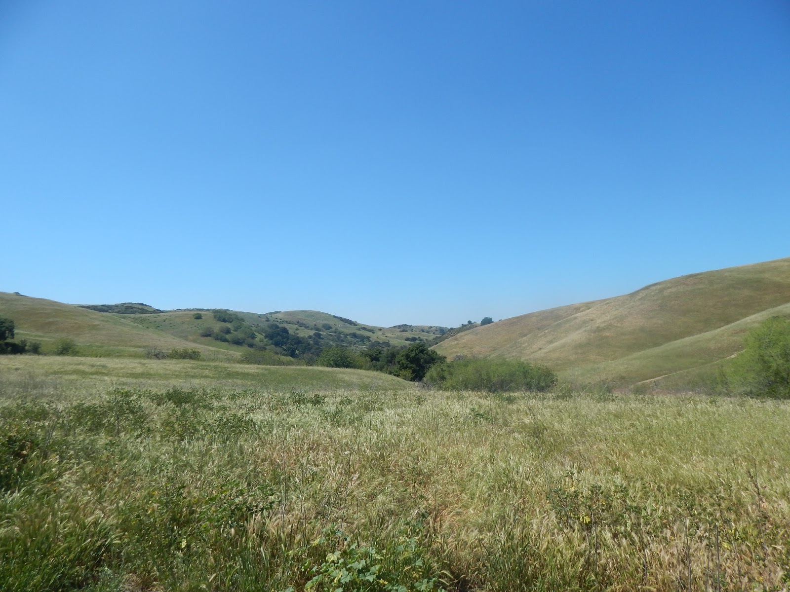
The entire ranch contains some 35,000 acres, beautifully situated in the Spadra valley, six miles East of Spadra and within three-quarters of a mile of the railroad.  Ten thousand acres of Mr. Hellman's purchase is moist land and capable of producing anything that grows in semi-tropical California.  The whole tract is well-watered by streams from the adjacent mountains and foot-hills, and besides has numberless springs flowing the year round.   Heretofore it has been devoted to pasturage, but it is capable of much better things, and we expect some day to see it divided into small farms and under the best state of cultivation.
The paper's geographical knowledge was a bit skewed.  The Southern Pacific railroad line, completed to Spadra in 1874 and to Colton a year or so later, was about five miles north.  Spadra was a community established by the excellently-named William W. Rubottom on a corner of Rancho San Jose and named for Rubottom's Arkansas hometown.  Later in 1875, the new town of Pomona was created on that same ranch and Spadra is now an almost-forgotten remnant of an industrial section of the city along Pomona Boulevard between the 71 and 57 freeways.  The Chino ranch is actually southeast of Spadra and constitutes its own Chino Valley.

Praising Hellman's wisdom in acquiring the Chino ranch, the paper claimed "we doubt not that it is well worth a half million dollars."  Well, at the time, the real estate boom in the Los Angeles area was such that the assigned value by the Herald might have seemed realistic.

Los Angeles Herald, 13 June 1875.
A month after the purchase announcement, photographer S.P. Smith of the short-lived Cottage Gallery in Los Angeles took a "photographic tour", covered by the Herald, of points east from the growing city, including San Gabriel, El Monte, Spadra, San Jose (what became Pomona) and the Chino Ranch.  There, Smith and his party met a Mr. Stewart, a native of Great Britain, who was leasing the ranch for sheep-raising, these animals having replaced cattle in many of the region's ranches.

Smith observed it was the last day of sheep shearing (say that ten times fast) and then took photographs of the ranch and the stock of animals for Stewart (it would be great if prints of these views were still around).  After spending the night at Chino, Smith and his party finished taking more photos, enjoyed "a bountiful breakfast," packed up and headed back for Los Angeles.  The article ended with the statement that
Should you ever visit the Chino Ranch you will find a pleasant place, a social and entertaining host, and have a good time generally.  Them's our sentiments.
By mid-June, however, a short notice appeared in the paper noting that
We learn from parties who profess to know that the Chino ranch will be cut up into small farms, and that a town will be laid off.  The surveying will be commenced this coming week.  This movement serves to confirm the report of the change of route of the Los Angeles and Independence R.R., published in the [San Bernardino] Argus a few days ago.
The Los Angeles and Independence Railroad, a project led by F.P.F. Temple and intended to tap the transportation of silver from mines near the Inyo county town of Independence, was in the process of construction, starting with a branch line from Los Angeles to the new resort town of Santa Monica.  The line opened later in 1875, but only lasted a little over a year before being absorbed by the Southern Pacific.

At around the same time, the Centinela ranch (near today's Los Angeles International Airport) and Lake Vineyard (modern Alhambra and San Marino) had been or were soon to be subdivided for sale, so Hellman and his unnamed partners were looking to cash in on the action while the real estate market was white hot.

A little over two months later, though, a deep chill descended on the economy--speaking metaphorically, as it was the dog days of a very warm August.  Silver mining speculation gone haywire in Virginia City, Nevada collapsed, sending shockwaves to San Francisco, which was the financial center of the silver frenzy.  The Bank of California, the state's largest, went belly up and the telegraph ticked the news southward to Los Angeles, where a panic erupted.  Both of the commercial banks, Temple and Workman and Farmers and Merchants, suspended business for a month to try to allay depositors' fears.

Los Angeles Herald, 4 November 1875.
Hellman was in Europe, but furiously cut short his trip when he learned what Downey had done when Temple and Workman asked for assistance in ordering the suspension of business.  Notably, that took place on 1 September 1875, the day of the county elections and F.P.F. Temple, president of his namesake bank, was elected Los Angeles County treasurer.  Rushing back home in what might have been a record time, Hellman borrowed money in New York from his financial connections there and, upon arrival in Los Angeles, reopened his bank with the new-found cash, thereby saving his bank.

As for Temple and Workman, there was no such luck.  Their reputation for loose management (which Hellman had experienced first hand when they were all partners) kept them from obtaining a loan, especially as the well-heeled in San Francisco sat on their surpluses.

But, another investor in southern California real estate, Elias J. "Lucky" Baldwin, who bought the Rancho Santa Anita (modern Arcadia and nearby areas) in spring 1875, loaned Temple and Workman money, but at a devil's bargain, most revealed in the satanic details of the mortgages issued to cover the loan.  Temple and Workman's gamble failed and the bank collapsed in January 1876.  The boom was over and a bust was on.

Still, in early November 1875, the Herald published another long piece on the Chino Ranch, observing that
The largest tract of moist land in Southern California and unquestionably the finest body of farming land on the Pacific Coast, is comparatively uninhabited.  We refer to the Chino Ranch . . .
Describing the property as a "savanna . . . entire covered with waving grass," the paper went on to note that "a splendid road free from dust (owing to the moisture of the land) passes across the center of the ranch", this describing the Butterfield Stage road, now roughly the route of the 71 Freeway.

Then, the piece continued, "on either side as far as the eye can reach are seen vast herds of cattle feeding upon the rich grasses," with an estimate of some 10,000 cattle and horses given.  The animals were said to be kept hydrated by abundant cienegas (springs) found throughout the ranch.  In fact, this blogger's first Chino Hills home included access to one such spring--when a backyard plant died and was pulled out of the heavy clay soil, just below the hills adjoining Chino Hills State Park, water rose to the surface and did not stop for seven years afterward.

Los Angeles Herald, 10 November 1875.
Going on to describe the "sandy loam" of the soil and the abundant water, the article claimed that the little agriculture practiced at Chino yielded "fifty to sixty bushels of barley, seventy-five to one hundred bushels of corn, and fifteen to eighteen tons of alfalfa" and some forty to sixty bushels of wheat.

The platitudes just kept coming:
As a place of residence no part of California is superior to this valley, the climate being superb and the scenery excellent . . . the immigrants arriving now are directing their attention to the East of Los Angeles. and this large ranch, capable of supporting three or four thousand people, will soon be thickly settled.  Lovely villas will ere long dot the beautiful plain, and the hum of industry be heard on all sides.
If the estimate of four thousand people sounds ridiculously low, the Herald must have realized it, because a brief note in the paper on 10 November, stated that Chino "is capable of supporting a half million of people" but at the time "is now only a wild expanse on which graze sheep and cattle."  As for those villas, Payne Ranch, Oak Tree Downs and Vellano might be the closest examples today.  The "hum" is more likely our growing street traffic and the rumble of trucks in south Chino!

The article ended with the note that investors with Hellman in the Chino Ranch included his banking partner Downey, San Francisco capitalist Alexander Weill and Louis Phillips, owner of the southern portion of Rancho San Jose, namesake of the Phillips Ranch community of Pomona and whose home, the 1875 Phillips Mansion, is a Pomona historic landmark.

Sacramento Record-Union, 31 December 1880.
The 1875-76 economic disaster proved to be a decade-long depression locally.  Any plans to develop the Rancho Santa Ana del Chino were shelved.  The plans of Hellman and his partners for quick, immense profits vanished, but another investor showed up at the end of 1880.  Flush with cash from the sale of mines at Tombstone, Arizona, Richard Gird made a deal with Hellman and associates, as briefly reported in the Sacramento Record-Union of 31 December 1880:
I.W. Hellman, the banker, is said to have sold to Dick Gird, an Arizona millionaire, the Chino Ranch for $225,000.
Hellman's half share cost him $150,000, so there was something of a loss, but it didn't hurt the financier in the long run.  He went on to run the Nevada Bank and Wells Fargo and was one of the wealthiest people in western America until his death in 1920.

As for Gird, he was buying at a good time, when prices were still low.  Within five years, a transcontinental railroad built by the Atchison, Topeka and Santa Fe reached Los Angeles and ushered in a new population and land boom exponentially greater by far than that of the late 1860s and early 1870s.  Like Hellman, though, Gird did not do well on his investment in the Chino Ranch--no one would until E.J. Marshall, Texas oil tycoon, bought the largely-intact ranch and took advantage of good market conditions after 1907 to finally make a good profit on speculation in the Chino Valley.

17 March 2016

Carbon Canyon Historic Artifact #50: La Vida Mineral Springs Coffee Shop, 1960s

Here's another in the growing set of 1960s chrome postcards from the "Arts Card" series by Escondido's Amescolor Publisher of views from the La Vida Mineral Springs resort; in this case, the interior of the coffee shop.

Many tell-tale signs of the era are there in the decor--the vinyl covered booth and lunch counter stool seats and backs, the formica tops with aluminum edging, the three-part gold-colored light fixtures, the faux brick wall in the back separating the kitchen from the dining area.

This is also the case with some of the people--check the guy at the left with the loud red Hawaiian shirt, shades, sandals and straw hat.  One of his table mates obviously demonstrated that there was no "No Shirt, No Service" restriction—after all, they probably came straight from the baths.


The woman seated at the counter and looking at the camera has one a very bright and busy patterned dress--apropos of the era. As for the waitress at the right behind the counter, she is sporting a lovely lime green uniform.

The windows at left faced the parking lot and Carbon Canyon Road would be in that direction.  Behind the counter and the row of dispensers, cabinets and other material was Carbon Creek and the hillside.  The building was narrow left to right and longer from the photographer, on the east end, toward the kitchen, on the west side, because of the configuration of the property.

Today, it's hard to visualize, when at the site, all of the elements that were there, from the coffee shop to the motel to the bath house.  But, when this image was taken about a half-century ago, La Vida was still a well-kept and busy place, though that was going to change over the next couple of decades.

12 March 2016

The Chino Ranch Ride in Soquel Canyon

In April 1937, as part of a three-day celebration of the fiftieth anniversary of Richard Gird's subdivision of the town of Chino, a core event in the area, which was widely-known for its equestrian ranches and farms, was a Community Day ride featuring some 1,200 horses, either ridden individually or hitched to a variety of vehicles.

The ride took place in downtown Chino as part of a five-division parade, featuring high school marching bands, guest marshals, poses from the sheriff's departments of San Bernardino and Riverside counties, police and fire departments, scouts, and others.  The four judges included Revel L. English, a nationally-known horse breeder, whose ranch covered a good portion of today's Chino Hills and whose name survives through English Springs Park and English Road.

The horse ride proved so popular that it was decided to make it a stand-alone annual event, but there was a change of venue.  Scouting of nearby locations found a secluded spot in Soquel Canyon, several miles southwest of downtown Chino in Soquel Canyon locatd in the Chino Hills.  Because the route passed by the Los Serranos Country Club, that institution made an ideal partner for the ride in terms of a starting and stopping point, as well as a place to have a dance and dinner.


With an organization, the Chino Ranch Ride Association, created to organize and execute the ride, it it became one of the primary community events in the Chino Valley.  The artifact shown here is the program for the thirteenth edition in 1949.

The inside front cover includes a "History of the Ride", which notes that there were "two occasions when bad weather just pededing the Ride forced it to be held on the high ground at the summit."  This reference is actually to Carbon Canyon and its summit, where the "high ground" might be where the Carriage Hills subdivision is located now.

As to the regular location of Hidden Valley, the history commented that
the setting for the Ride was selected after considerable search through the hills but when the committee discovered the glade in Soquel Canyon, with its natural amphitheater, ample space for tethering of mounts and area for the barbeque[,] they decded that here was an idea spot for such on occasion.
Hidden Valley is almost directly due south of Sleepy Hollow, just over a ridge with a steep drop down into Soquel Canyon.  As noted, this area widens from narrowed sections on either side, providing much room for all of the activities, serving of food and other services for the ride.


An attempt to establish a historical setting for the Ride was added from the early days of the event and replicated in this 1949 history, when it noted that
Fable has it that the famed California bandit, Joaquin Murietta, and his hand used this hide-away in the early days, his lookouts using the hill-tops for sighting the approach of stage coaches and caravans on either side.  They could swoop down out of the hills on forays against the unsuspecting travellers and escape to their natural fortress from which it would have been difficult to route [rout] them  because of the inaccessbility of the area. Here they had abundant shelter, lush meadows and cool, clear water for their horses from the creek that, in those days, flowed steadily throughout the year.
There may actually be some tidbits of truth here.  Joaquin Murrieta allegedly emerged from the fields of the California Gold Rush after experiencing racism from Americans and Europeans evicting Mexican, South American and Chinese miners from good claims in the Sierra Nevada Mountains and began a career as a bandit.  At one point in the early 1850s, it was claimed that he was seen in five distinct areas of the state.

When in November 1852, militia general and bar owner Joshua Bean, whose younger brother became the famed Judge Roy Bean in Texas, was murdered at his Headquarters Saloon in San Gabriel, it was claimed that Murrieta's girlfriend was accosted by Bean and that the bandit chief ordered another man to kill the offender.

In summer 1853, the California State Rangers, created by the state for Murrieta's capture and led by Harry Love, a former bounty hunter, was said to have found the gang near what became Fresno and, after a pitched battle, Murrieta was killed.  Allegedly he was decapitated and the head preserved in a liquor-filled jar for identification.  It was reported that the grisly relic was displayed in San Francisco where it was destroyed in the great earthquake and fire of 1906.


If Murrieta was occasionally in the Los Angeles region, it is possible that he and others used the Chino Hills and Soquel Canyon areas as a rendezvous and attack point.  After all, one of the main roads into the region came up from Yuma, across the deserts, up through Warner Springs in San Diego County, then Temecula and along the eastern flanks of the Chino Hills, where a main stopping point was Isaac Williams's Rancho Santa Ana del Chino home, on what is now Boys Republic in Chino Hills.  From there, the road went into modern Pomona, went around the northern reaches of the hills and then into the lower San Gabriel Valley and westward to Los Angeles.

Although the 1949 pamphlet stated that bandits in the Chino Hills could observe "on either side," the main road through the plains of what is now Orange County is quite a bit to the west, roughly paralleling Interstate 5, but it may be possible that robberies were carried out there, as well.

And, as noted, Soquel Canyon does have those "lush meadows" and, though not so much in these drought-stricken days, "cool, clear water" so that shelter in "Hidden Valley" might well have attracted bandits 150 years ago.  In fact, there'll be an entry soon in this blog that discusses one likely use of the canyon for a murderer--but, check back later for that one.

Regarding events for the 1949 ride, it included prizes and ribbons to those entered in fifteen categories, including for men and women; youngest and oldest riders to control their horses; for palominos, quarter horses and pintos; and for the Best Law Enforcement Group, among others.


Also of note were the many advertisements contained in the program, including the Heinaur-Griffith Mortuary, Bassett's general store, La Cita Cafe (offering "Spanish" and American food), Paul Ramos's grocery store and meat market, Gene's Cafe and Cocktail Ounge, Karlson's Service Station, Van Dusen's Department Store, Chino Lumber Company, Van Arnold's Ford dealership, and Los Serranos Country Club, which "welcomes Chino Rancho Riders and Their Guests" and invites them to "Dine and Dance Dressed As You Are," as western wear replaced something more formal.

The Chino Ranch Ride was a major event in the valley for decades and, though it has long been discontinued, there are still physical remnants of the Hidden Valley location.  These include concrete block walls for structures, sections of pipe fencing, rusting water troughs, and other relics.

Meantime, come back soon for more Soquel Canyon history and stories.

03 March 2016

Madrona Appeal: Good News, Bad News

It has been reported that the City of Brea has decided not to appeal the ruling against the Madrona development, which proposed 162 houses on over 350 acres on the north side of Carbon Canyon between Sleepy Hollow and Olinda Village in Brea.

That's the good news.

However, the property owner, Old Standard Life Insurance Company, which is in receivership with the State of Idaho, has decided to pursue an appeal.

There's your bad news.

It may be about 18 months before a hearing actually takes place before the appellate court.  Hopefully, that court will uphold the lower (Superior) court ruling, based on the very thorough examination of the facts in evidence that comprised that decision, including the casual violation of the city's own ordinances relating to the matter.

In the meantime, lead plaintiff, Hills for Everyone, which has led the lengthy battle against this poorly-conceived and potentially-destructive development, will be needing help raise funds to continue the fight.  Stay tuned here or check out the HFE Web site here for more.

But, we will see when that time comes!