Showing posts with label Chino Hills State Park hiking. Show all posts

26 March 2016

A Trek Through Chino Hills State Park

Yesterday's excursion in the Chino Hills north of Carbon Canyon was a qiuck walk around the block compared to today's marathon 15-mile trek through Chino Hills State Park (with a 13-year old, no less.)

A portion of the South Ridge Trail looking westward.
The hike began at the park's Discovery Center in Brea at about 8:30 or so, with the intention of heading up the North Ridge Trail, which overlooks Carbon and Soquel canyons.

Just one of many spots along the South Ridge Trail to take in panoramic views of inland Orange County and nearby areas.
But, the trail was closed, apparently because of some unstable areas, so plans were altered to head up Telegraph Canyon and, then about 1 1/2 miles in, a quick, steep ascent up the Diemer Trail (named for Metropolitan Water District of Southern California chief Robert Diemer, for whom the adjacent water treatment plant is also named) to the South Ridge Trail.

A nice detail of the rolling hillsides and taller hills northeast of the South Ridge Trail, with remnants of a few short poles, some with lines still attached, that appear to be from a late 19th-century telegraph line from the new towns of Chino to Carlton.
The walk then headed east along with some steep ascents and descents and spectacular views to the south and west, albeit with some coastal haze, towards inland Orange County and out towards the Santa Ana Mountains.

It had been some years, probably fifteen or so, since this blogger had been on this trail, so, while the views were not surprising, what had been forgotten was just how close some of the housing tracts in Yorba Linda are to the state park.

A section of the South Ridge Trail literally runs along the backwards of several Yorba Linda tract houses at the Rimcrest entrance.  Great for local access to wildland areas, but graffiti and broken better bottles were found at nearby overlook.
In fact, the Rimcrest entrance is very convenient, because it is just steps from that street to the park and access via South Ridge or the aptly-named Easy Street Trail, which descends into Telegraph Canyon.

But, the flip side comes with an overlook just to the west of Rimcrest that once had an interpretive sign, but now is a graffiti-marred base, with some rock formations spray-painted, and lots of broken bits of glas from beer bottles to serve as a reminder that sometimes it is made too easy for some people to get to nature.

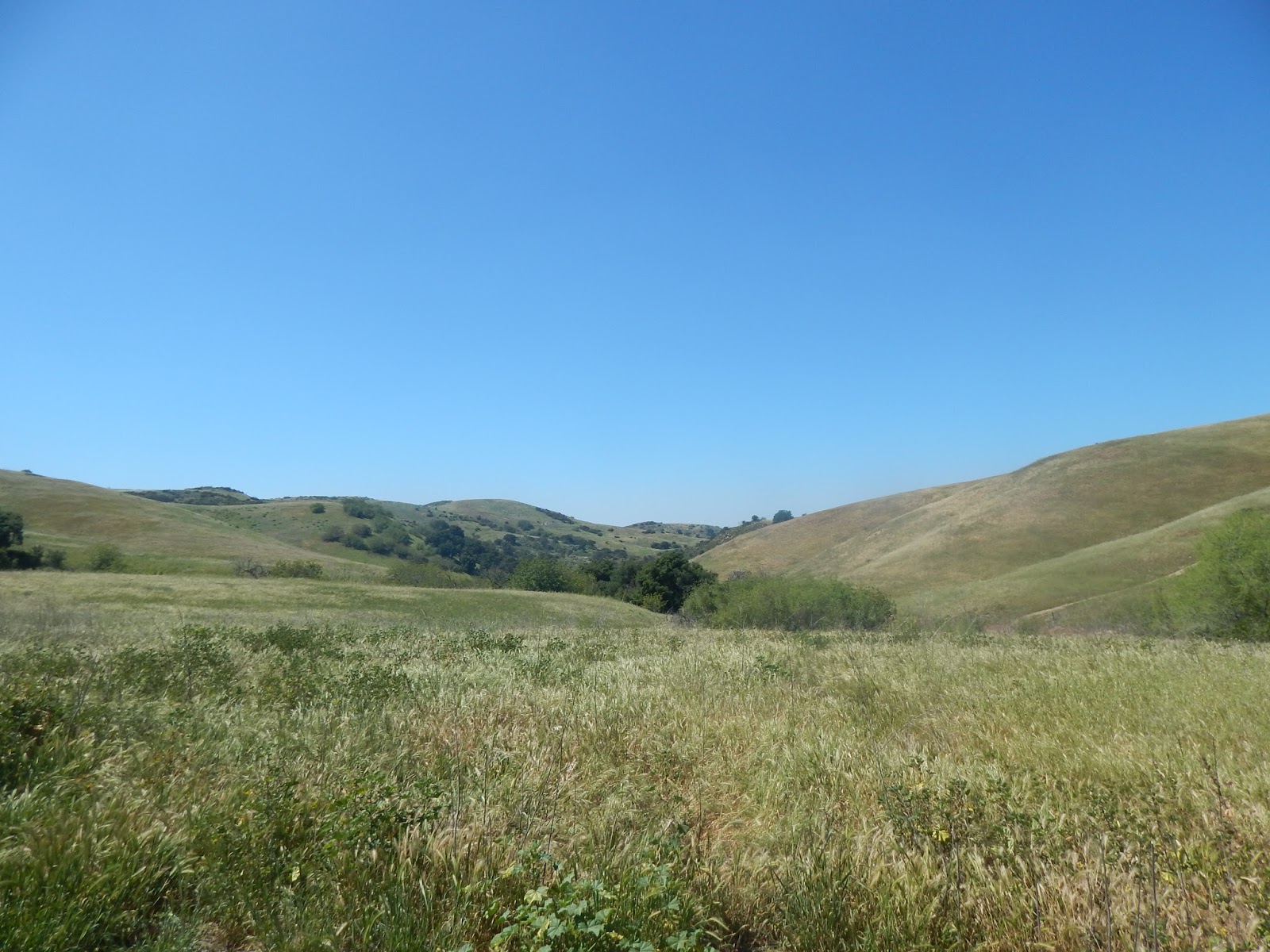
Another fine view of the park, looking west from the South Ridge Trail.
At any rate, a steep series of climbs along South Ridge east of Rimcrest, where the partiers likely couldn't, or wouldn't, go leaves the mess behind.

Just short of the highest point at that portion of the park, San Juan Hill, is a side trail called Bovinian (bovine meaning "cattle") that winds along a pretty hillside route and then descends and turns into the Desire Trail the further drops down along a nice route to Telegraph Canyon.

A section of the Desire Trail, heading down slope from the South Ridge Trail, via the Bovinian Trail, to Telegraph Canyon.
Here the trail terminates at Four Corners, which is one of the central points of the park.  A covered picnic area, interpretive signage and maps, and a Porta-Pottie are there to provide a nice place to rest.  Having gone some 8+ miles to that point, there was about a half-hour break before the hike pressed on.  From there, Telegraph Canyon continues east, Raptor Ridge heads northeast, and the Gilman and McDermont trails head north to the North Ridge Trail.

Reached by several trails, Four Corners is a great place to stop and rest and enjoy the wide open spaces and solitude of Chino Hills State Park.
Following Telegraph Canyon westward, just a couple of hundred feet or so away, leads to McDermont Springs, one of the few places where there is water within the park.  From there, it is a good 6 1/2 miles or so along the mostly flat road back towards the Discovery Center.

Just off the Telegraph Canyon Trail a short distance west of Four Corners (where the trees are at the upper left) is McDermont Springs, one of the few water sources in the park.
The first part of the walk features some abundant shade, tall and spreading oaks and sycamores, and the Aliso Creek running alongside the trail.  There was a nice spot south of the road with a picnic table near the creek and well-shaded by oaks, with an impressive oak grove across the trail.

A nice grove of oaks along the Telegraph Canyon Trail, not far west of Four Corners.
Both along the South Ridge Trail and at Telegraph Canyon are old wooden poles, perhaps 12-15 feet tall, with, in some cases, wire still hanging from them.

Again, it had been years since these areas were last visited, but it dawned that these were almost certainly the old telegraph poles and lines from which the canyon got its name.

The thickly-shaded sections of the Telegraph Canyon Trail are seen in this view looking west from Four Corners.
Recent research has shown that there was a plan in the late 1880s, during the famous population and land boom of the time, when Richard Gird, the owner of Rancho Santa Ana del Chino and the founder of the town of Chino, planned to build a railroad from his new community out to another new townsite, Carlton, on the Olinda Ranch.

The railroad was projected to go through Soquel Canyon and then exit out where it meets Carbon Canyon in today's Olinda Village and then on to Anaheim.  More on this project, which never got beyond the planning stage when the boom went busted by 1889, in a later post on this blog.

Several remnant poles, apparently from that telegraph line, dot the hillside heading north from Telegraph Canyon up to the North Ridge Trail. Click on any photo to see these in enlarged views in a separate window.
But, it seems likely that a telegraph line was built to connect the new towns and that the line ran through the steep terrain of what is now the state park and maybe a dozen poles and pieces of line still remain as physical reminders of that old way of communication.

The last several miles of the walk through Telegraph Canyon were through areas with fewer trees, less shade and wider areas with grasses, cacti and smaller shrubs and trees.  Once the Diemer Trail was reached and the water plant came into view, the home stretch brought a last burst of energy to make that final haul back to the Discovery Center.

One of the prettier portions of Telegraph Canyon, west of Four Corners, on the westbound trek back to the Discovery Center.
It was about 2:30, a little less than six hours from the start, when the Easter weekend adventure ended and it was an eggcellent way to spend an early spring Saturday.

30 December 2015

Another Short Jaunt Through Chino Hills State Park

From the Lilac Trail in the northwest corner of Chino Hills State Park behind Olinda Village in Brea looking across Sonome Canyon.  The water tank at the left was where the main stop was made on the trek.
Yesterday's trek through the heart of Chino Hills State Park was such a great experience that it felt like it was time for an encore.  So, this morning a similar distance was hiked and it took about the same time--in this instance, the walk went through the little-utilized section of the park on the north side of Carbon Canyon above the Olinda Village community in Brea.

A nice little view of part of Sonome Canyon as framed by a couple of native oaks along the La Vida Trail.
Starting at about 11:30, the excursion used the Lilac Trail and headed up a pretty good incline along a wide road, until about a mile up or so.  This blogger has hiked that trail up to some transmission towers at the northwest corner of the state park property, behind the Olinda Alpha Landfill, a few times, but this time a right turn was made onto the La Vida Trail.

This route heads eastward and descends down into Sonome Canyon, which is at to the north behind Olinda Village.  The descent is generally nice and gradual and wends down to the canyon bottom where there are what appear to be two branches of the canyon--one northwest and the other northeast.

The northwest branch of Sonome Canyon from the La Vida Trail.
Creeks or washes come from both drainages and it can only be imagined, given the parched conditions of the last four years, what extensive rainfall, such as that expected in the next few months, will bring to these secluded and pretty areas.

In the northwest branch, the trail crosses where the creek drops down and there is a spot there where  drop of several feet must provide for a nice little waterfall when there is actually a flow there.

The La Vida Trail is at the left as it descends down into Sonome Canyon with its main branch dead ahead.
Over in the northeast or main canyon, just before the trail turns to head up the east slope, a little side path led about fifteen feet off the trail to the dry creek, but with shade from trees, this could be a great little spot to rest and enjoy the quiet, solitude, and, if available, the water flow in the creek.

Perhaps a visit in the spring is in order to see what these locales are like after the rains we expect to have--provided that there aren't trail washouts, that is!

Having ascended the eastern slope of Sonome Canyon, this is looking back at the main branch.
The climb up the eastern slope of Sonome Canyon was a decent one and comes out to the paved road that leads to the dual water tanks and the cell tower that serve the Olinda Village area.

A little walk around the tanks and tower and a short descent to the southeast provided a very nice spot to rest in the shade of an oak tree and enjoy the panoramic views and the general quiet (although traffic from Carbon Canyon Road to the south could be heard.)

From the water tanks and cell tower, this image looks over where the Madrona project entrance was slated to be next to the former Manely Friends stable along Carbon Canyon Road.  Two ridgelines back is the main portion of Chino Hills State Park.
The descent back towards the village included a side trail that skirted the winding paved road.  Shortly after rejoining the road, though, there was a broad flat bench with a narrow trail leading out towards a sort of promontory.

A road drops down from this point along the shadowed area at the right of center to the historic La Vida Mineral Springs property.  Carbon Canyon is at the center and the north ridge of the main section of the state park in the distance.
From that area there were excellent views of Olinda Village to the west, but especially striking ones of Carbon Canyon to the east, especially the narrowing of the steep canyon walls on the Brea side and then the fanning out of the back of the canyon over on the Chino Hills side.

This was a nice way to finish out a short, but rewarding, hike through a seldom-visited area.  After heading through the well-manicured village neighborhood, the walk concluded with another great experience and a reminder of why living in Carbon Canyon has so many benefits.

From a flat bench or promontory above Olinda Village was this excellent view of Carbon Canyon as the narrow defiles in the Brea portion open to the fanned-out back of the canyon in Chino Hills.
Seeing the graded top of the Canyon Hills housing tract and looking at what could have been the massive Madrona project and the pending Hidden Oaks development is another kind of reminder, though.  As flatter lands below are taken by development, the fight for hillsides and hilltops will only intensify, despite the traffic issues, fire risks, water supply questions, habitat loss and other issues.

Those of us who walk these hills need to be more appreciative of what we have and what can be lost if our local governments approve more housing in the canyon.

29 December 2015

A Short Jaunt Through Chino Hills State Park

Along the South Ridge Trail, this view takes in the overlap of gently rolling hills of a section of Chino Hills State Park, looking towards the Santa Ana Mountains in the Cleveland National Forest.
Today was a great day to get out on a hike through our local crown jewel of the outdoors: Chino Hills State Park.  The weather was cool, but the sun was out in a cloudless sky, and there was hardly a soul to be seen in the few hours out on the trails-only one biker was encountered from 11:30 to 2.

After the 3-mile drive in via the new Bane Canyon Road entrance, the walk started at the Rolling M Ranch, the headquarters during the years when much of the northeastern portion of the park was privately owned--first as part of Rancho Santa Ana del Chino, then by the Chino Land and Water Company, then from 1921 by the Pellissier family of Whittier and, finally, from 1948 by Christopher Hendra's Mollin Investment Company until 1720 acres were sold for the park.

Along the lower portions of the South Ridge Trail, what appears to be a discarded metal water tank from the private ranching years sits among the slopes with Mount Baldy, Ontario Peak and Cucamonga Peak rising from the San Gabriel Mountains in the distance.
Two main trails head west from the ranch site and the walk started with the South Ridge Trail, which eventually, as its name cleverly indicates, follows the southern boundary of the park over on the Yorba Linda side.  The hike took in the first 2.5 miles of the trail, which include some lung-bursting and quad-burning climbs up steep sections, but there is a payoff.

Towards the top (there is more climbing to the highest elevations on the trail) there are a pair of Edison transmission towers where excellent views can be had, mainly of the areas looking out toward Ontario, San Bernardino, Norco, Corona, Riverside, the Santa Ana Mountains, and, on clear days (and today was pretty good), beyond to the Big Bear/Lake Arrowhead area, Mount San Gorgonio, and Mount San Jacinto.  Discerning eyes can even, on occasion, pick out Mount Palomar, way off in San Diego County.

On a level area near two Edison transmission towers after a steep ascent on the South Ridge Trail are panoramic views like this from Ontario at the far left to Temescal Canyon at the far right.  At the center in the distance is San Gorgonio Pass flanked by Mount San Gorgonio at its left and Mount San Jacinto on its right. Note, too, how the gently rolling hills in the foreground contrast with the steeper, wrinkled hills at the eastern edge of the park along the 71 Freeway/Expressway.
Today's trek was limited by time, so the walk headed back down the steep trail to take a side trail that meets up with the Telegraph Canyon Trail, the other of the two main trails noted before.  Telegraph Canyon is, by far, the longest of the trails in the park, spanning a good 9 miles one way.  A few miles in is Four Corners, a meeting point of several trails, which, these days, boasts a covered picnic table and a porta-pottie--in the 90s when this blogger did a lot of trekking through the park, there was just an exposed table.

Time did not permit heading out to Four Corners, though, so the final 2 miles of the walk consisted of heading back, mainly downslope, on the Telegraph Canyon trail back to the ranch.  On the way, though, was passed the trailhead for what was once the most beautiful part of the park--the Hills for Everyone Trail.

Just right of center is the fairly-new state park campground and the equestrian area just to the right.  In the background is south Chino, Eastvale and Norco, Riverside and out to Mount San Gorgonio in the distance.
From the mid-90s and into the early 2000s, this blogger enjoyed several walks along this gorgeous route, which wound through a heavily wooded (oaks, sycamores and black walnuts) area with a creek that had water a good part of the year.  After 10-12 mile hikes via the steep climbs on the South Ridge or the Raptor Ridge Trail leading to the North Ridge and then a return by Telegraph Canyon, a great way to finish the day was to stroll through the cool shade and pause to dip a toe in the creek along the Hills for Everyone route.

Unfortunately, the trail was not maintained when the state went through the worst of its economic crises and the park barely had any staffing or services and erosion and other problems caused the closure of the route.  Someday, perhaps, the work will be done to bring the Hills for Everyone back to life, because it was the highlight of a visit and it is sad to see it in its decrepit state.

The views west aren't quite as panoramic and steeper hills to the southwest are there, as well, but here is a nice look out on the Telegraph Canyon Trail to Four Corners, about dead center, and the hills along the North Ridge Trail looking out towards Brea.
After about 2.5 hours and 5 miles, the walk concluded.  It would have been better if twice the time and distance could have been invested and covered, but that will have to be for another day.