Yesterday's excursion in the Chino Hills north of Carbon Canyon was a qiuck walk around the block compared to today's marathon 15-mile trek through Chino Hills State Park (with a 13-year old, no less.)
 |
| A portion of the South Ridge Trail looking westward. |
The hike began at the park's Discovery Center in Brea at about 8:30 or so, with the intention of heading up the North Ridge Trail, which overlooks Carbon and Soquel canyons.
 |
| Just one of many spots along the South Ridge Trail to take in panoramic views of inland Orange County and nearby areas. |
But, the trail was closed, apparently because of some unstable areas, so plans were altered to head up Telegraph Canyon and, then about 1 1/2 miles in, a quick, steep ascent up the Diemer Trail (named for Metropolitan Water District of Southern California chief Robert Diemer, for whom the adjacent water treatment plant is also named) to the South Ridge Trail.
 |
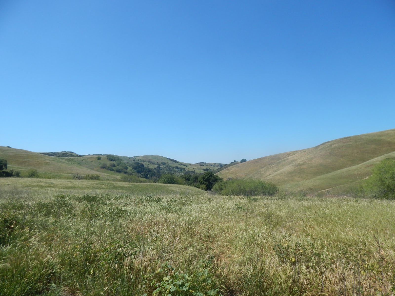
| A nice detail of the rolling hillsides and taller hills northeast of the South Ridge Trail, with remnants of a few short poles, some with lines still attached, that appear to be from a late 19th-century telegraph line from the new towns of Chino to Carlton. |
The walk then headed east along with some steep ascents and descents and spectacular views to the south and west, albeit with some coastal haze, towards inland Orange County and out towards the Santa Ana Mountains.
It had been some years, probably fifteen or so, since this blogger had been on this trail, so, while the views were not surprising, what had been forgotten was just how close some of the housing tracts in Yorba Linda are to the state park.
 |
| A section of the South Ridge Trail literally runs along the backwards of several Yorba Linda tract houses at the Rimcrest entrance. Great for local access to wildland areas, but graffiti and broken better bottles were found at nearby overlook. |
In fact, the Rimcrest entrance is very convenient, because it is just steps from that street to the park and access via South Ridge or the aptly-named Easy Street Trail, which descends into Telegraph Canyon.
But, the flip side comes with an overlook just to the west of Rimcrest that once had an interpretive sign, but now is a graffiti-marred base, with some rock formations spray-painted, and lots of broken bits of glas from beer bottles to serve as a reminder that sometimes it is made too easy for some people to get to nature.
 |
| Another fine view of the park, looking west from the South Ridge Trail. |
At any rate, a steep series of climbs along South Ridge east of Rimcrest, where the partiers likely couldn't, or wouldn't, go leaves the mess behind.
Just short of the highest point at that portion of the park, San Juan Hill, is a side trail called Bovinian (bovine meaning "cattle") that winds along a pretty hillside route and then descends and turns into the Desire Trail the further drops down along a nice route to Telegraph Canyon.
 |
| A section of the Desire Trail, heading down slope from the South Ridge Trail, via the Bovinian Trail, to Telegraph Canyon. |
Here the trail terminates at Four Corners, which is one of the central points of the park. A covered picnic area, interpretive signage and maps, and a Porta-Pottie are there to provide a nice place to rest. Having gone some 8+ miles to that point, there was about a half-hour break before the hike pressed on. From there, Telegraph Canyon continues east, Raptor Ridge heads northeast, and the Gilman and McDermont trails head north to the North Ridge Trail.
 |
| Reached by several trails, Four Corners is a great place to stop and rest and enjoy the wide open spaces and solitude of Chino Hills State Park. |
Following Telegraph Canyon westward, just a couple of hundred feet or so away, leads to McDermont Springs, one of the few places where there is water within the park. From there, it is a good 6 1/2 miles or so along the mostly flat road back towards the Discovery Center.
 |
| Just off the Telegraph Canyon Trail a short distance west of Four Corners (where the trees are at the upper left) is McDermont Springs, one of the few water sources in the park. |
The first part of the walk features some abundant shade, tall and spreading oaks and sycamores, and the Aliso Creek running alongside the trail. There was a nice spot south of the road with a picnic table near the creek and well-shaded by oaks, with an impressive oak grove across the trail.
 |
| A nice grove of oaks along the Telegraph Canyon Trail, not far west of Four Corners. |
Both along the South Ridge Trail and at Telegraph Canyon are old wooden poles, perhaps 12-15 feet tall, with, in some cases, wire still hanging from them.
Again, it had been years since these areas were last visited, but it dawned that these were almost certainly the old telegraph poles and lines from which the canyon got its name.
 |
| The thickly-shaded sections of the Telegraph Canyon Trail are seen in this view looking west from Four Corners. |
Recent research has shown that there was a plan in the late 1880s, during the famous population and land boom of the time, when Richard Gird, the owner of Rancho Santa Ana del Chino and the founder of the town of Chino, planned to build a railroad from his new community out to another new townsite, Carlton, on the Olinda Ranch.
The railroad was projected to go through Soquel Canyon and then exit out where it meets Carbon Canyon in today's Olinda Village and then on to Anaheim. More on this project, which never got beyond the planning stage when the boom went busted by 1889, in a later post on this blog.
 |
| Several remnant poles, apparently from that telegraph line, dot the hillside heading north from Telegraph Canyon up to the North Ridge Trail. Click on any photo to see these in enlarged views in a separate window. |
But, it seems likely that a telegraph line was built to connect the new towns and that the line ran through the steep terrain of what is now the state park and maybe a dozen poles and pieces of line still remain as physical reminders of that old way of communication.
The last several miles of the walk through Telegraph Canyon were through areas with fewer trees, less shade and wider areas with grasses, cacti and smaller shrubs and trees. Once the Diemer Trail was reached and the water plant came into view, the home stretch brought a last burst of energy to make that final haul back to the Discovery Center.
 |
| One of the prettier portions of Telegraph Canyon, west of Four Corners, on the westbound trek back to the Discovery Center. |
It was about 2:30, a little less than six hours from the start, when the Easter weekend adventure ended and it was an eggcellent way to spend an early spring Saturday.


No comments:
Post a Comment